 > Our
Services > Air Traffic Engineering Services > Functions of Various Air Traffic Control Equipment / Facilities for the HKIA
> Our
Services > Air Traffic Engineering Services > Functions of Various Air Traffic Control Equipment / Facilities for the HKIA
Functions of Various Air Traffic Control Equipment / Facilities for the HKIA
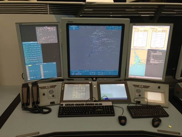
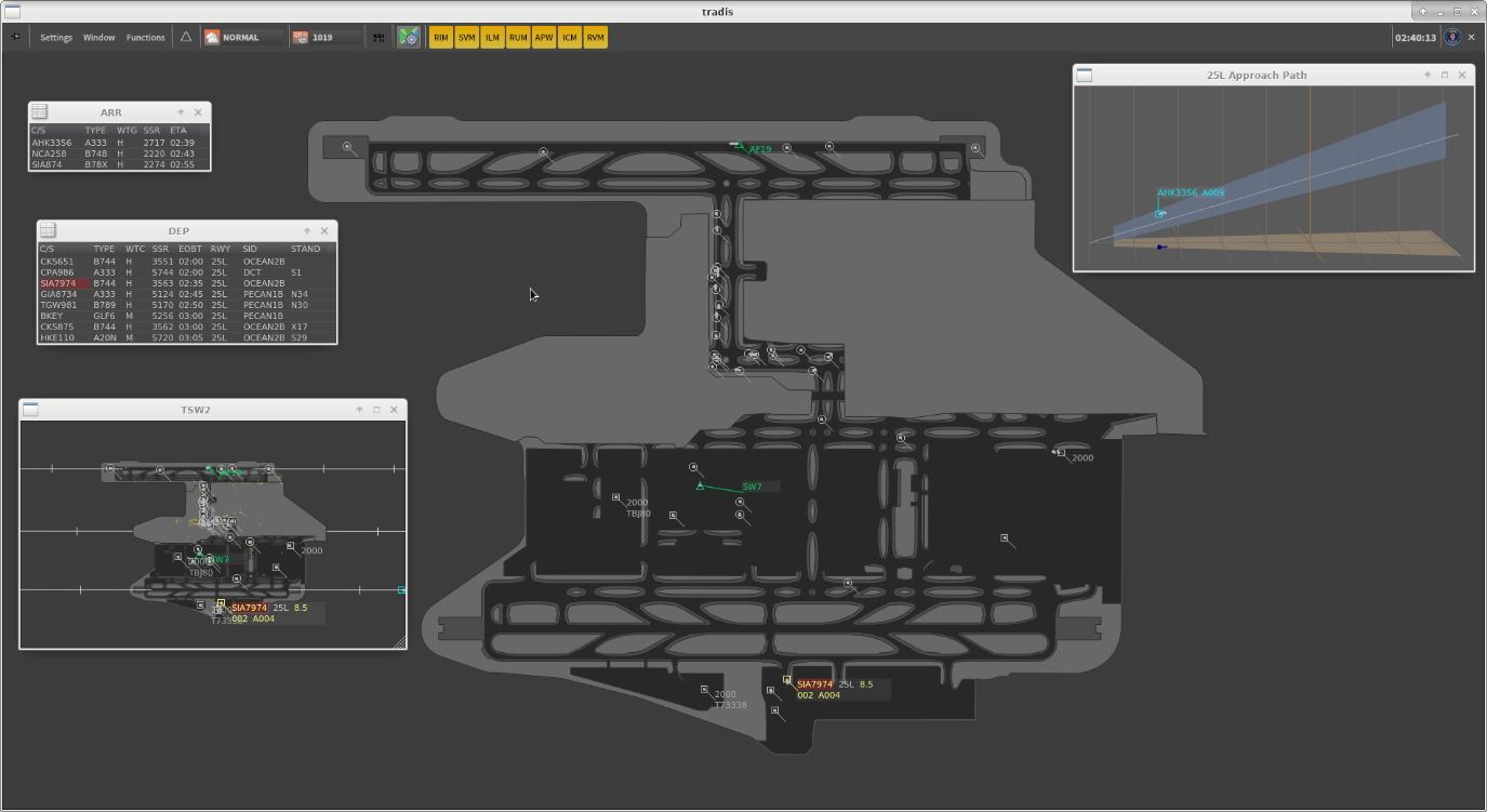
faqCounter. Air Traffic Management System (ATMS)
ATMS processes the flight plans and surveillance data from various surveillance signal input sources, including primary and secondary surveillance radars as well as ADS-B system, to present details of the aircraft information (e.g. aircraft position, altitude, callsign, ground speed, aircraft category, etc.) on the screen of air traffic control working positions to facilitate the management of air traffic by the air traffic control officers.
ATMS can handle 8 000 flight plans per day and can simultaneously monitor 1 500 air or ground targets, making it fully capable of coping with anticipated air traffic growth.
In addition, ATMS includes three sub-systems, namely Main system, Fallback system, and Ultimate Fallback System (UFS). The Main and Fallback systems are identical systems. UFS is an independent system with software and system configuration completely detached from the Main and Fallback systems. The purpose of this design is to reduce the risk of complete system breakdown due to failure of both the Main and Fallback systems, which safeguards flight safety.
ATMS ensures extremely high availability through multiple layers of infrastructures such that in case of temporary issues in a single system, air traffic controllers could continue to provide the air traffic services seamlessly in another system.
ATMS is equipped with the advanced information technologies, including enhanced flight information and data processing, more precise flight trajectory prediction functions, multi-surveillance tracking technology, advanced automatic safety net features, weather prediction and display including Constant Altitude Plan Position Indicator (CAPPI) from Hong Kong Observatory, electronic flight strip, silent coordination ability between ATC Centre and ATC Tower, etc.
Air Traffic Management System (ATMS)
faqCounter. Air Traffic Service Data Management System (ATSDMS)
ATSDMS includes (i) an enhanced Air Traffic Control Data Network, which is the communications backbone for all ATC systems and (ii) an Operational Information Database System, which provides an integrated operational displays for real-time air traffic services information.
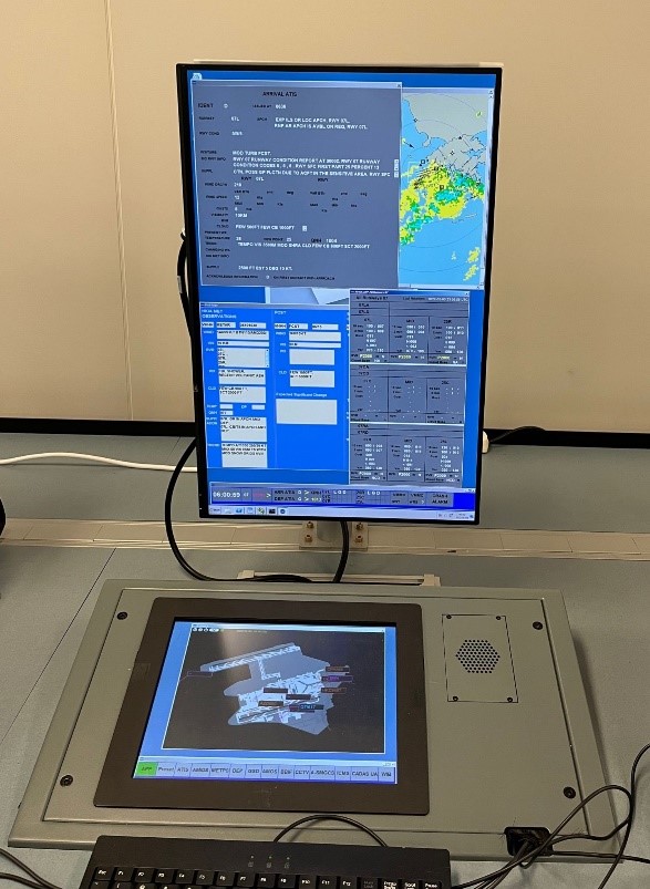
Air Traffic Service Data Management System (ATSDMS)
faqCounter. Aeronautical Information Management System (AIMS)
AIMS is an information management system used for the generation, distribution and storage of Notices to Airmen, as well as management of flight plans and other aeronautical information for use by air traffic flight services officers and pilots.
faqCounter. Aeronautical Messaging System (AMS)
AMS consists of two major components - Aeronautical Telecommunications Network (ATN) Router System and Regional Operational Meteorological Bulletin Exchange (ROBEX) System.
The ATN Router System supports the exchange of air traffic services messages among the Air Traffic Services Message Handling Systems (AMHS) in Hong Kong and the adjacent Communications (COM) Centre, while the ROBEX System is for storing meteorological messages and disseminating them to the neighbouring Communications (COM) Centre in the Asia Pacific Region.
faqCounter. Communication Backbone (CB)
CB is a communication network consisting of Synchronous Digital Hierarchy rings and Microwave links interconnecting the communication, navigation, surveillance and air traffic management systems located in the CAD Air Traffic Control Building/Tower and outstations in various areas of Hong Kong.
faqCounter. Voice Communication Switching System (VCSS)
VCSS is a computerised voice communication system for direct communication between pilots and air traffic control officers, and between air traffic control working positions in the ATC Centre, ATC Tower and Rescue Coordination Centre, by using pre-set aeronautical frequencies, direct communication lines and telephone lines.
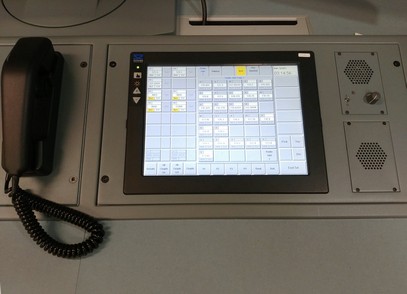
Voice Communication Switching System (VCSS)
faqCounter. Digital Recording System (DRS)
DRS continuously record, 24 hours a day, the air/ground radio and telephone communication channels between Air Traffic Control Center/Control Tower and other external organisations; as well as the screen displays of certain key air traffic control systems within the Air Traffic Control Center/Control Tower. These recordings are crucial for air traffic controllers' training and for accident or incident investigations.
faqCounter. Automatic Terminal Information System (ATIS)
ATIS is a VHF broadcasting system for continuous dissemination of vital information (e.g. updated airfield, meteorological and navigational aids serviceability information, etc.) to flights departing from or arriving at HKIA. The public can also access the information by calling 3141 2820 (for arrivals), 3141 2705 (for departures) or by browsing ATIS.
faqCounter. Automatic VOLMET Broadcast System (AVBS)
AVBS is used to automatically broadcast at regular intervals the pre-recorded meteorological information for various airports including Hong Kong and the neighbouring aerodromes (e.g. Guangzhou, Naha, Taipei, etc.).
faqCounter. Air Traffic Services Message Handling System (AMHS)
AMHS is a ground-to-ground communication system for supporting air traffic services message exchange among Hong Kong and overseas ATC centres, enabling timely and reliable dissemination of aeronautical information over Aeronautical Telecommunications Network and Aeronautical Fixed Telecommunication Network to secure flight safety and efficiency.
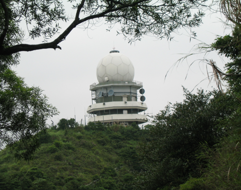
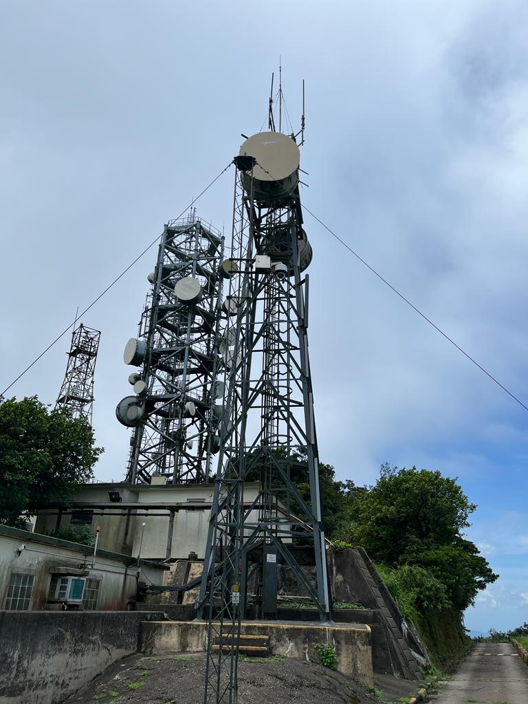
faqCounter. Primary Surveillance Radar (PSR)
PSR detects and provides both the range and bearing information of an aircraft within its effective coverage by radio wave reflection. Depending on the operational need and external environmental conditions, the coverage may reach 80NM for approach control or 200NM for en-route control purpose. A short range PSR is installed at Sha Chau to detect aircraft operating within the approach and departure areas of the HKIA.
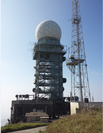
Tai Mo Shan Terminal Area Radar
faqCounter. Secondary Surveillance Radar (SSR)
SSR provides, after processing, the range, bearing, altitude and callsign of an aircraft. Depending on the operational need and external environmental conditions, the coverage may reach 250NM. It can provide more useful information than PSR but is subject to the proper functioning of the aircraft's transponder. To provide the best accuracy of aircraft position, it is usually paired with a PSR for air traffic control purpose.
Mount Parker Route Secondary Surveillance Radar
faqCounter. Advanced Surface Movement Guidance and Control System (A-SMGCS)
A-SMGCS employs both the multilateration and Automatic Dependent Surveillance-Broadcast (ADS-B) technologies for enhanced surveillance of aircraft and vehicle movement in the airfield, and provision of conflict and runway incursion alerting functions for improved flight safety and efficiency. The accurate surface movement information provided enables the air traffic control officers to maintain a smooth flow of traffic during low visibility conditions.
Advanced Surface Movement Guidance and Control System (A-SMGCS)
faqCounter. Automatic Dependent Surveillance - Broadcast (ADS-B) System
ADS-B System receives and processes the messages broadcasted from aircraft, covering the aircraft identification, position, altitude, air speed, and heading, etc. The ADS-B data can cover the entire Hong Kong Flight Information Region (HKFIR).
faqCounter. Surface Movement Radar (SMR)
The SMRs are mounted on the top of five lattice towers in various locations in HKIA for surveillance of aircraft and vehicles on the runways and taxiways. It provides real-time surveillance information to A-SMGCS to enable the air traffic control officers to maintain a smooth ground movement during all weather conditions.

Surface Movement Radar (SMR)
faqCounter. Radar Simulator (SIM) System
Radar Simulator (SIM) System is a replica of the ATMS and is used for the training of air traffic control officers as well as the evaluation of air traffic control procedures.
faqCounter. Control Tower Simulator (CTS)
The CTS, which is equipped with state-of-art projection and image generation technologies, simulate the aerodrome environment of the Three-runway System operations to facilitate the Aerodrome Control Training.
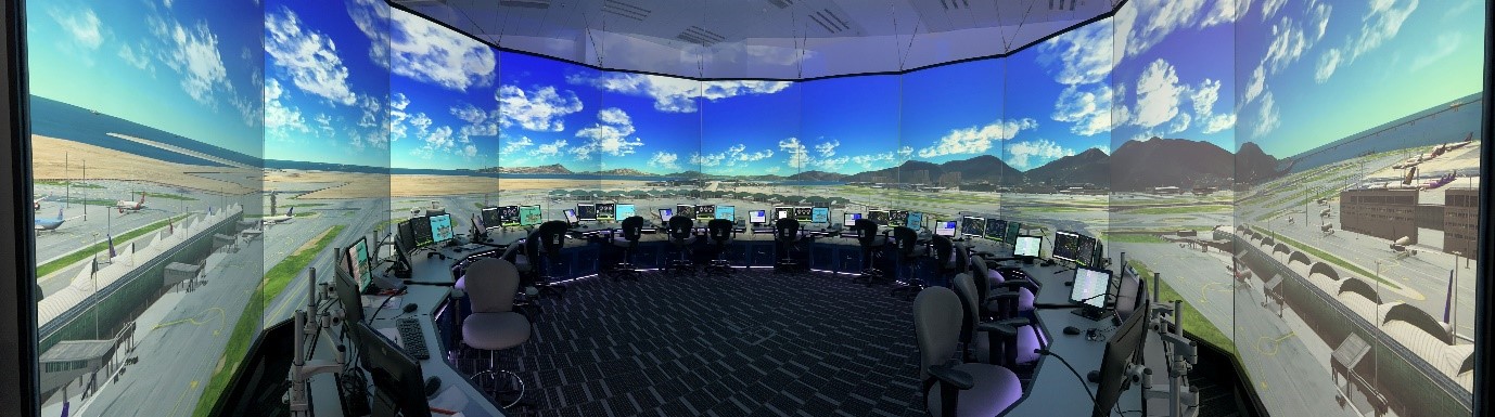
Control Tower Simulator (CTS)
faqCounter. Instrument Landing System (ILS)
Instrument Landing System (ILS) provides accurate azimuth and descent guidance signals for use by aircraft landing on the runway under normal or adverse weather conditions. On each runway, two ILSs, each consists of a 32-element ultra-wide aperture Localiser (LOC) antenna array, M-Type 3-element Glide Path (GP) antenna system and bi-directional Distance Measurement Equipment (DME), are commissioned successfully and in operation.

LOC Antenna Array
GP and DME during a flight check
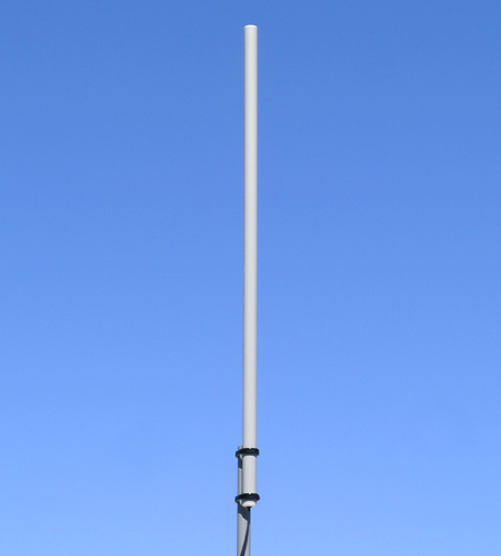
faqCounter. Doppler Very High Frequency Omni-directional Radio Range and Distance Measuring Equipment (DVOR/DME)
DVOR/DME provides bearing and distance information to aircraft, and assists navigation along air traffic control routes for en-route, terminal and approach operations. They are installed at Tung Lung and Siu Mo To to support arrival and departure at HKIA.

Siu Mo To DVOR/DME
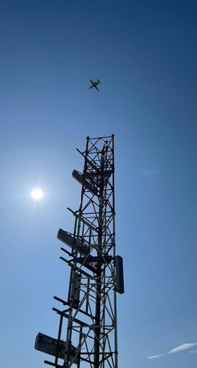
faqCounter. High Frequency/Very High Frequency (HF/VHF) Communication Equipment
The radio equipment includes signal transmitters and receivers operating on various frequencies used for both the long-range and short-range air/ground communications with aircraft. They are installed at Cape D'Aguilar, Mount Butler, Victoria Peak, Tai Mo Shan, North Lantau, Mount Parker, Beacon Hill, Lung Kwu Chau and on-airport antenna farms.
Very High Frequency Communication Equipment (VHF)
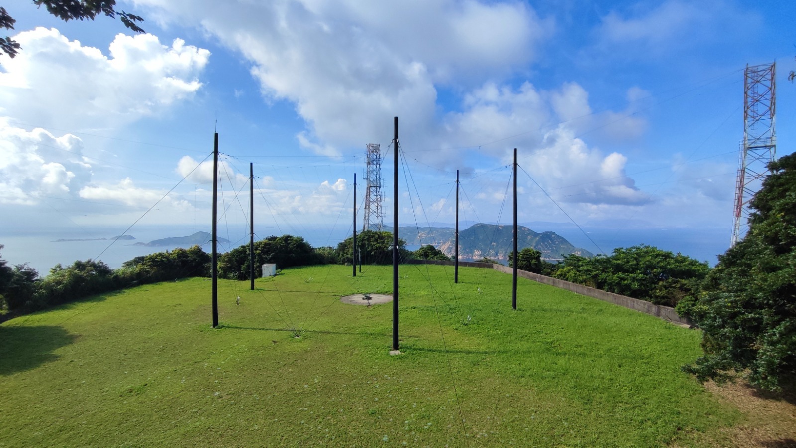
High Frequency Communication Equipment (HF)
faqCounter. Microwave Link System (MLS)
MLS conveys radar and air/ground communication signals, equipment status and remote control signals between various CAD radars, navigational aids and communication stations, the ATC Centre, ATC Tower and Watchkeeping Control Centre.
Microwave Link System (MLS)
faqCounter. Master Clock System (MCS)
MCS sets the time standard according to the time reference derived from the Global Positioning System and Hong Kong Observatory. It is also used to synchronise the time among various ATC systems of the HKIA, as well as to display standard time for air traffic control purpose.
faqCounter. Common Aeronautical Virtual Private Network (CRV)
The CRV is a common network infrastructure in the Asia Pacific (APAC) Region initiated by the ICAO with a view to overcoming the existing limitations in the communications of legacy civil aviation technologies mostly relying on serial-based point-to-point circuits, and to constructing a centralised IP-based private network infrastructure by adopting modern technology to support future high-speed aviation applications, including exchange of meteorological and surveillance data between different Aviation Navigation Service Providers.
Being a major aviation hub in the APAC Region, CAD has established connections to CRV and utilised such connections for operational voice communication and data exchange with neighbouring area control centres. Hong Kong and Manila was the first city-pair in the region operating voice communication on CRV. Subsequently, data exchange with Bangkok, Beijing, Fukuoka and Manila were also put into operational use one by one.
faqCounter. Air Traffic Flow Management (ATFM)
Air Traffic Flow Management (ATFM) is an air traffic management process for avoiding the traffic demand exceeding the available capacity in a pro-active manner. Through the monitoring of the traffic demand, capacity and constraints of airports or airspaces, appropriate actions could be taken to balance the demand for ensuring efficient use of available capacity. The use of ATFM can reduce the on-air delays of aircraft by optimising the traffic demand and contributes to a safe, efficient, cost-effective and sustainable air transport system.
faqCounter. Air Traffic Services Inter-facility Data Communication (AIDC)
The AIDC, being one of the key functions integrated in the ATMS, supports electronic transfer of aircraft with Sanya, Guangzhou, Xiamen, Shanghai, Taipei and Manila ACCs to enhance flight safety and also operational efficiency through the Aeronautical Fixed Telecommunication Network.
faqCounter. Digital Tower Facilities (DTF)
DTF are equipped with ultra-high resolution (4K) surveillance cameras with video recognition technology to provide real-time digitised video panoramic views of HKIA. Aircraft and vehicles images showed on those panoramic views were augmented with relevant information. Artificial intelligence is applied to the digitised video to provide additional safety alert functions, such as early detection of conflicting situation or intrusion to airfield restricted areas, with an aim to lift the overall efficiency and situation awareness of air traffic controllers at the HKIA.
The Digital Apron and Tower Management System (DATMS) at the HKIA won the 2023 Technology Innovation Awards of the Airports Council International for "Best Innovation in Airport Operations and Installations Management", commending the joint efforts of the CAD and Airport Authority Hong Kong in implementing innovative technologies for enhancing safety and operational efficiency at the HKIA.
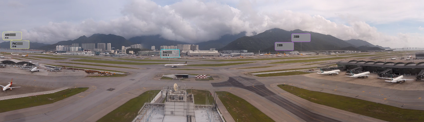
Digital Tower Facilities (DTF)
faqCounter. Cyber Security
Cyber security is one of the most critical issues in the global aviation industry. The ICAO has set up the Cybersecurity Panel (CYSECP) to support the implementation of related work. AESD has been providing technical support and advisory to the Civil Aviation Administration of China (CAAC) in their work of the ICAO CYSECP. This also facilitates AESD personnel to keep abreast of the latest international development in this field.
To cope with the ever-changing cyber security landscape, the CAD regularly conducts activities to safeguard our Air Navigation Services (ANS) equipment and Information and Communication Technology (ICT) systems against cyber threats, and to achieve a zero-incident cyber security record. The AESD, working jointly with cyber security experts and various divisions of the CAD, held the Attack with Defence (AWD) exercise to strengthen our preparedness and determination to cope with cyber threats. (Event Video)
faqCounter. Approach Spacing Management System (ASMS)
The ASMS at the Air Traffic Control Centre has been implemented for enhancing the operational efficiency in handling aircraft's final approach operation under enhanced wake turbulence separation scheme and for improving consistency in delivering arrival traffic spacing. With the completion of system acceptance testing, flight check and relevant safety assessment and trial operation, the ASMS has been put into operation since March 2024.
The ASMS implementation has led to substantial benefits, including reduced airborne delays, increased runway capacity and fuel savings with reduction in CO2 emissions from aircraft. The implementation received the runner-up honours in the "Greener Skies" category of the Air Traffic Management Awards 2023 presented by the Civil Air Navigation Services Organization (CANSO). This award recognises the achievements of CAD in utilising advanced technologies to promote sustainable and environmentally friendly air navigation services.
